


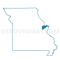
227-Whitmoor Voting District, St. Charles County, Missouri
About
Outline

Summary
| Unique Area Identifier | 609634 |
| Name | 227-Whitmoor Voting District |
| County | St. Charles County |
| State | Missouri |
| Area (square miles) | 8.12 |
| Land Area (square miles) | 6.90 |
| Water Area (square miles) | 1.23 |
| % of Land Area | 84.90 |
| % of Water Area | 15.10 |
| Latitude of the Internal Point | 38.69497200 |
| Longtitude of the Internal Point | -90.59527160 |
Maps


Graphs
Select a template below for downloading or customizing gragh for 227-Whitmoor Voting District, St. Charles County, Missouri


Neighbors
Neighoring Voting District (by Name) Neighboring Voting District on the Map
- 129-Parkwood Voting District, St. Charles County, MO
- 150-Timberwood Voting District, St. Charles County, MO
- 220-Pitman Voting District, St. Charles County, MO
- 228-Shoshone Voting District, St. Charles County, MO
- 230-Claybrook Voting District, St. Charles County, MO
- 231-Wolfrum Voting District, St. Charles County, MO
- 234-Windcastle Voting District, St. Charles County, MO
- CHE002 Voting District, St. Louis County, MO
- CHE018 Voting District, St. Louis County, MO
- CHE048 Voting District, St. Louis County, MO
Top 10 Neighboring County Subdivision (by Population) Neighboring County Subdivision on the Map
- Chesterfield township, St. Louis County, MO (38,982)
- Cottleville township, St. Charles County, MO (23,534)
- Harvester township, St. Charles County, MO (20,573)
Top 10 Neighboring Place (by Population) Neighboring Place on the Map
Top 10 Neighboring Unified School District (by Population) Neighboring Unified School District on the Map
- Parkway School District, MO (140,234)
- Rockwood School District, MO (116,321)
- Francis Howell School District, MO (113,553)
Top 10 Neighboring State Legislative District Lower Chamber (by Population) Neighboring State Legislative District Lower Chamber on the Map
- State House District 12, MO (42,937)
- State House District 84, MO (36,467)
- State House District 14, MO (35,805)
- State House District 16, MO (34,474)
- State House District 86, MO (33,904)
Top 10 Neighboring State Legislative District Upper Chamber (by Population) Neighboring State Legislative District Upper Chamber on the Map
- State Senate District 2, MO (242,885)
- State Senate District 23, MO (170,166)
- State Senate District 7, MO (160,542)
Top 10 Neighboring 111th Congressional District (by Population) Neighboring 111th Congressional District on the Map
Top 10 Neighboring Census Tract (by Population) Neighboring Census Tract on the Map
- Census Tract 3111.22, St. Charles County, MO (6,773)
- Census Tract 2216.28, St. Louis County, MO (6,717)
- Census Tract 3111.03, St. Charles County, MO (6,622)
- Census Tract 3113.22, St. Charles County, MO (5,786)
- Census Tract 3111.14, St. Charles County, MO (4,550)
- Census Tract 3111.48, St. Charles County, MO (4,517)
- Census Tract 3111.32, St. Charles County, MO (3,447)